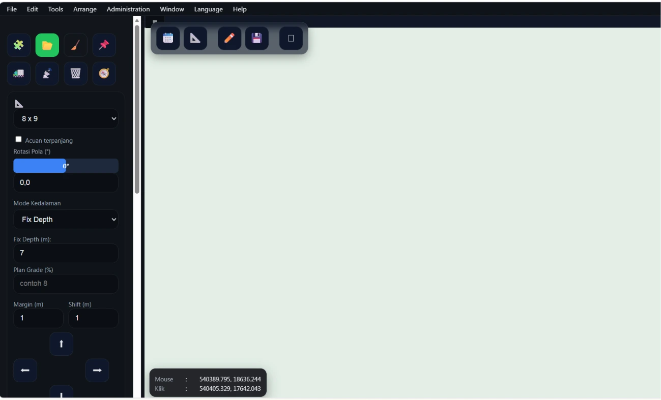
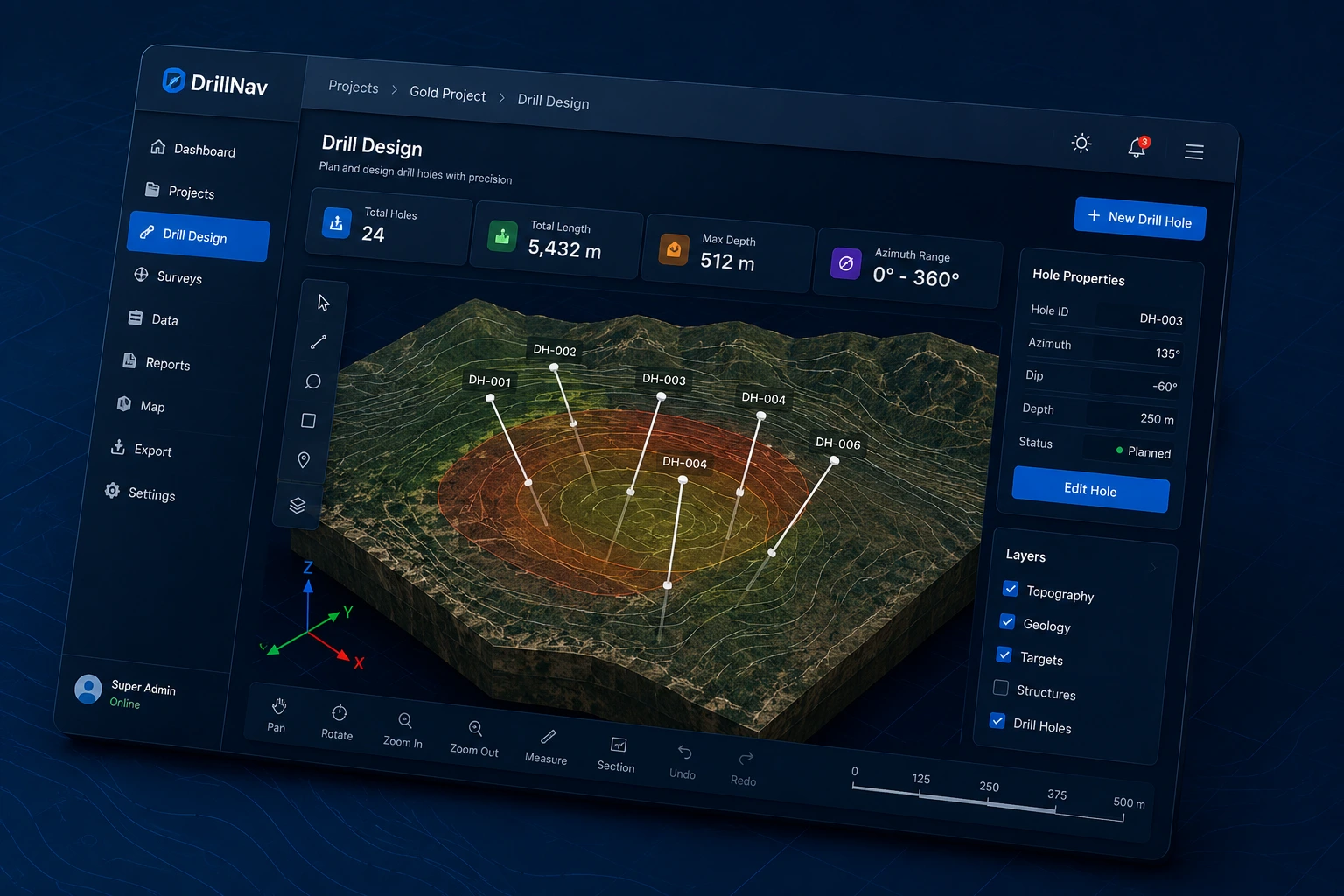
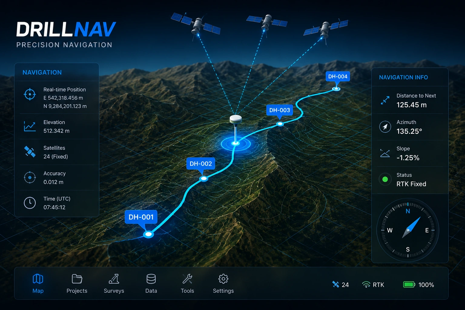
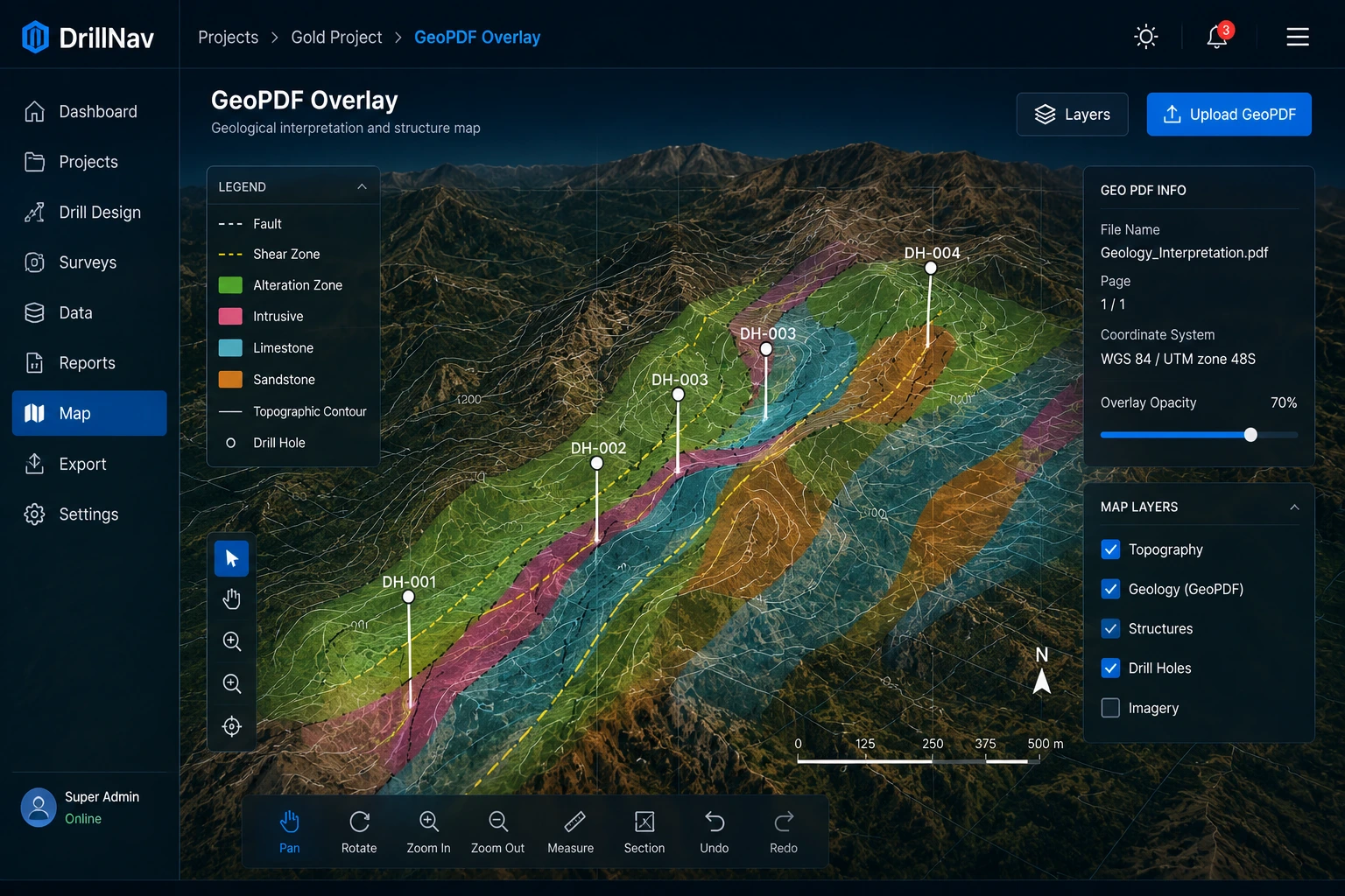
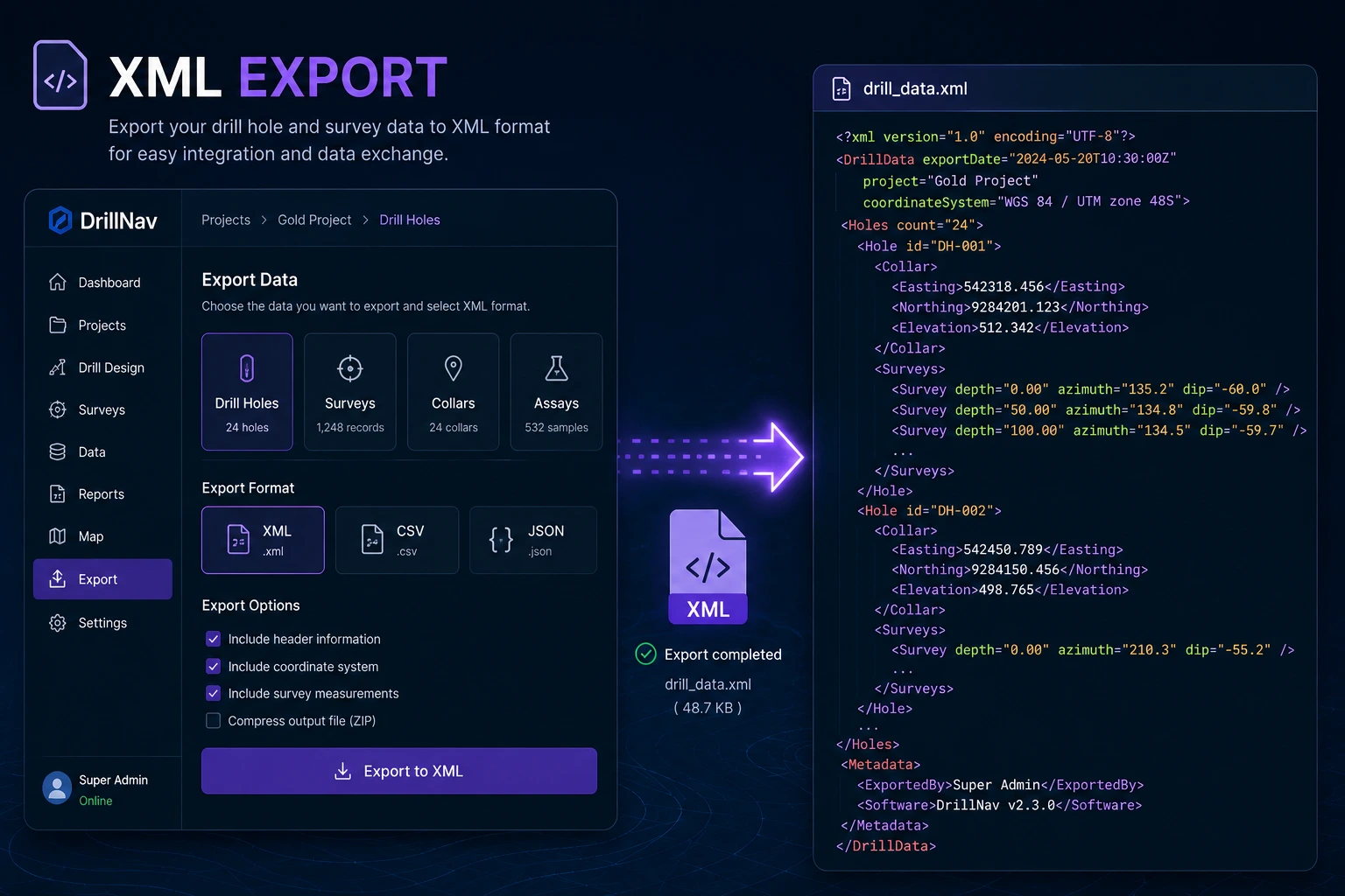
The complete drill and blast platform for planning, GeoPDF visualization, GPS navigation, Sandvik XML export and field execution.
TRUSTED BY MINING PROFESSIONALS
Built specifically for modern drill and blast operations.
Operate in remote mining locations without internet connectivity.
Seamlessly work between office planning and field execution.
Export directly to Driller's Office XML and IREDES workflow.
Overlay drill plans on geospatial maps with high accuracy.
Real workflows from planning to execution.
TXT, DXF, KML, GeoJSON and GeoPDF support.
Automatic drill design based on burden and spacing.
Review volume, area and drill pattern geometry.
Sandvik D245KX and Driller's Office compatibility.
Field guidance using GNSS and RTK devices.
Generate PDF reports and production documentation.
Everything required for modern drill and blast operations.
Create drill patterns from boundaries automatically.
Overlay plans and geospatial data accurately.
Navigate directly to drill holes in the field.
Generate machine-ready XML files instantly.
Manage drill plans and field activities efficiently.
Generate PDF reports and project summaries.
Flexible plans designed for mining operations of every size.
Perfect for evaluation and learning DrillNav.
Designed for individual drill & blast engineers.
Complete solution for drill & blast teams.
Multi-user deployment for mining companies.
Custom deployment for large mining operations.
DrillNav significantly reduced our drill planning time.
Senior Drill & Blast EngineerGeoPDF and GPS navigation are extremely useful in the field.
Mining SupervisorSandvik XML export works exactly as required.
Drilling ContractorYes. DrillNav is fully operational without internet connectivity.
Yes. XML export follows Driller's Office workflow.
Yes. DXF, GeoPDF, TXT, KML and GeoJSON are supported.
Join mining professionals using DrillNav to design drill patterns, navigate holes, manage GeoPDF overlays, and export Sandvik XML from a single integrated platform.